Navigation

This photo-blog is designed to work either as a standard blog with images or - by clicking any image - a photo-album. To see an image in full resolution click to the left or right of an image in blog mode.
Showing posts with label Andalucia. Show all posts

Tuesday, September 14, 2010

Priego de Cordoba

Approaching Priego de Cordoba in the evening

We then took off over the mountains on a little back road reaching Priego de Cordoba at sunset, finding that the camp site was supposed to be closed and after driving through finding the youth hostel closed and the only backpackers inaccessible down a side alley with no parking, finally succumbed to driving up into the mountains and gypsy camping in the moonlight on a mountain hilltop which proved in the morning to be overlooking a huge old castle and sweeping views of the mountains.

Scenes on the way there


The gypsy campsite above Zagrilla Alto

Distant castle from the campsite

Zagrilla Alto

Next morning, after wandering through Priego, which was charming, and recharging our caffeine at a cafe and watching the news that the 45 degree heat was becoming lethal in Madrid, and failing to find a free internet, we finally managed to get a booking for a hostel for tomorrow night for our two nights in Barcelona, by going to an internet cafe. The reservation was becoming a crisis because of he lack of internet access and the fact that Barcelona proved to be 99% booked out days in advance, taking out all the hostels in Lonely Planet, even for the dorms.

Panorama of the overlook from Priego promenade


The park facing the promenade


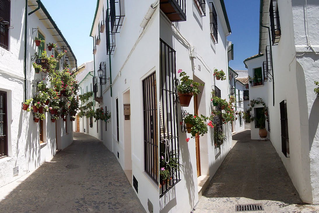
The Barrio de la Villa is the old Arab district with a strong Jewish presence

The calle is named after the Jewish philosopher Maimonedes


Calle Petunia


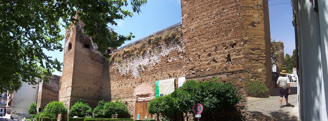
Panorama of the castle walls

The Church


The one hostel we could find the evening before had no available parking

The famous fountain Fuente del Rey or Fountain of the King


We then headed as fast as possible across country to Ronda, flagging Granada because we hate the big cities in this blazing heat. However for those of you who lament for the Alhambra in this Andalucian tour here is a sumptuous high resolution image set at Wikipedia's Alhambra site.

Scenes on the road to Ronda


Friday, August 6, 2010

For the Love of Ronda

Map of Ronda in the city centre

To make up for the bare bones of Ireland, Portugal and Andalucia, here is one posting exclusively devoted to one really neat city we visited in Spain. We had few details of Ronda except a warm recommendation from Arwen, a couple of fleeting images of a very high bridge, and a star on an old 1992 road map of Europe.

When we arrived the image was even more off-putting of a modern Spanish city with a typical commercial centre full of shuttered buildings surrounded by a suburban sprawl with supermarkets and industrial estates, however, when you look at the map in detail you can see that the whole city somehow focuses on a ravine and a crevice of city that crosses it in a thin wedge.

Its a city that goes back to fortress defences in Moorish times and continues as a religious centre drawn to the precipice of the ravine that marks the only passage across to the sanctuary on the high bluffs beyond, giving the city a unique mysterious persona.

In fact its history goes away back to the Celts who called it Arunda and it was already a city in the time of the Romans. Here is an extract from Wikipedia.

Around the city are remains of prehistoric settlements dating to the Neolithic Age, including the rock paintingsCueva de la Pileta. Ronda was however first settled by the early Celts, who, in the 6th century BC, called it Arunda. Later Phoenician settlers established themselves nearby to found Acinipo, known locally as Ronda la Vieja, Arunda or Old Ronda. The current Ronda is however of Roman origins[1], having been founded as a fortified post in the Second Punic War, by Scipio Africanus. Ronda received the title of city at the time of Julius Caesar.

In the 5th century AD Ronda was conquered by the Suebi, led by Rechila, being reconquered in the following century by the Eastern Roman Empire, under whose rule Acinipo was abandoned. Later the Visigoth king Leovigild captured the city. Ronda was part of the Visigoth reign until 713, when it fell to the Arabs, who named it Izn-Rand Onda ("city of the castle") and made it the capital of the Takurunna province.

After the disintegration of the caliphate of Córdoba, Ronda became the capital of a small kingdom, the taifa of Ronda. During this period Ronda received most of its islamic architectural heritage. In 1065 Ronda was conquered by the taifa of Seville led by Abbad II al-Mu'tadid. Both the poet Salih ben Sharif al-RundiSufi scholar Ibn Abbad al-Rundi (1333-1390) were born in Ronda.

The islamic domination of Ronda ended in 1485, when it was conquered by the Marquis of Cádiz after a brief siege. Subsequently, mostly of the city's old edifices were renewed or adapted to Christian roles, while numerous others were built in newly-created quarters such as the Mercadillo and the San Francisco ones. The Real Maestranza de Caballería de Ronda was founded in the town in 1572, with military finalities.

In the early 19th century, the Napoleonic invasion and the subsequent Peninsular War caused much sufference in Ronda, whose inhabitants reduced from 15,600 to 5,000 in three years. Ronda's area became the base first of guerrila warriors, then of numerous bandits, whose deeds inspired artists such as Washington Irving, Prosper Mérimée and Gustave Doré. In the 19th century the economy of Ronda was mainly rural. In 1918 the city was the seat of the Assembly of Ronda, in which the Andalusian flag, coat of arms and anthem were designed.

Ronda was heavily affected by the Spanish Civil War, after which much of the population emigrated elsewhere.


Streets leading down to the crevice

So after taking an overdone meal of burger king hamburgers chips and coke so Christine didn't have to cook, we drove down to the edge of town literally and passing a few intriguing houses with very odd sculptures, suddenly emerged on the precipice that marks the old edge of town.


(left) Humanoid figures of bird people on a set of pillars, whose origins remain a mystery


The lower passage

The lower passage crosses above the low bridge and the ascends in a steep winding cobble-stoned street with hair-pin bends which climbs up into the fortress bluffs that now house Christian sanctuaries, but were previously Moorish Muslim structures probably constituting a defensive fortress.

A panorama from above the lower passage

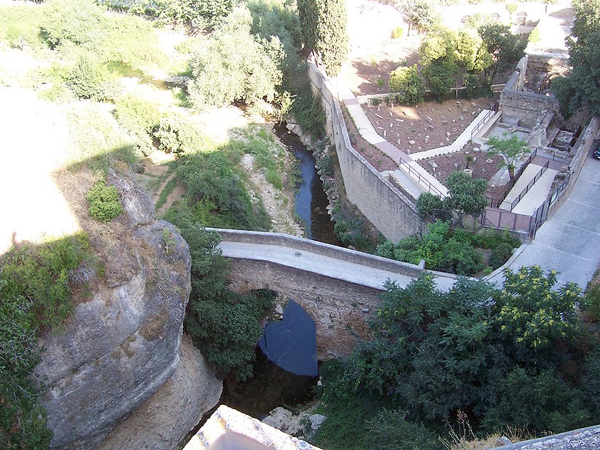
Looking down on the low bridge

The gardens descending steeply into the ravine

Views of the city from above

and out over the arid rocky surrounding landscape

The road ascends to a series of churches and buildings dating back to Moorish times

Moorish arch in the church above left

The church altar


The altar of the church above right across the courtyard from the previous one

Having looked around the critical area we headed off to el Sur camping a relatively luxurious camp site which even exceptionally had wi-fi for a fixed 3 euro fee for the whole time you were there.

Camping at el Sur


Panoramas returning to Ronda in the morning


Next morning having photographed the old town bluffs from a distance as we drove in, we entered through the gate in the castle wall and suddenly found ourselves launched onto the even more mind boggling precipice spanned by the so-called "New Bridge" a stunningly high stone bridge over the ravine crossing it higher up and further to the northern edge of the gap. This is the Ronda of those ephemeral picture I had seen while still in New Zealand and it is what completes Ronda for us as a gem of a city.

The castle walls

Buildings above the extreme ravine spanned by the "New Bridge"

The extremely high three layered "New Bridge"
Panorama south from the new bridge
The ravine

Ravine views

Reverse panorama looking north


The street above the "New Bridge"